
Acknowledging Joshua Tree’s First Nations
Joshua Tree National Park’s nearly 1 million acres contains multitudes. It encompasses 2 separate desert ecosystems, the higher, cooler, more arid Mojave Desert and the lower, warmer, wetter Colorado Desert. At more than 85% designated Wilderness, the opportunities for recreation and solitude are virtually limitless. The incredible cultural landscape of the Pinto, Chemehuevi, Serrano, Mojave and Cahuilla people occurs throughout the park and visitors can respectfully engage with Indigenous cultural artifacts and knowledge in numerous ways. These are not long forgotten, disappeared peoples; these tribes are active and striving and are deeply involved in land stewardship and management in Joshua Tree National Park. We are proud to support the Native American Land Conservancy, an inter-Tribal conservation organization whose mission is to acquire, preserve, and protect Native American sacred lands throughout Southeastern California and return them to traditional ecological management and create a space for reconnecting with the cultural heritage of the land. Another amazing organization to check out is the Cultural Conservancy and the Salt Song Trail Project. Please remember that these tribes are very much still a part of this land and we are visiting long inhabited landscapes. Tread lightly with respect and never remove or deface Native American artifacts or artwork.
European-descended settlers came to the area in the mid-1800s beginning with Mormon settlers crossing the Mojave Desert by wagon (and as the legend goes, naming the Joshua Trees for their resemblance to the prophet, Joshua, raising his arms to the heavens). More settlers arrived in the 1870s and into the 20 the century prospecting, mining, and grazing sheep and cattle, but the harsh climate kept it sparsely populated. Homesteading became popular in the 1930s and many more people began to settle in the area. Minerva Hoyt, a prescient naturalist and plant enthusiast worried about exploitation of the desert and the numbers of plants being destroyed or stolen from the desert and brought to the gardens of Los Angeles and she tirelessly worked to protect this unusual landscape. She created the International Deserts Conservation League in 1930 and is known as the first great desert conservationist. Her dogged persistence to protect Joshua Tree is widely credited with leading to the formation of Joshua Tree National Monument in 1936 under President Franklin Roosevelt.
Recommended Hiking Essentials
- Water- limit sugar and add electrolytes
- Sun Protection – loose, light colored clothes, big hat, sun glasses, sunscreen, lip balm
- Food- Plenty of salty snacks to replace salts lost from sweating
- First Aid Kit- tweezers, and even pliers, can be helpful for removing cactus spines from flesh
- Map- Paper map backup in case lack of service or battery means your phone is useless
- Headlamp or flashlight
Stay Safe in the Heat
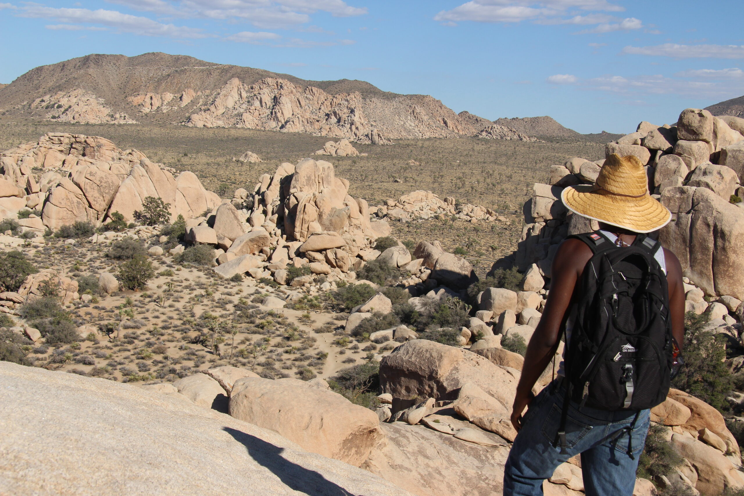
Many people feel the pull of the desert and enjoy the epic feeling of open space, sky, stars, rock, and the sense of vastness in the landscape. Joshua Tree has experienced exponential growth in visitorship over the last decade. However, this is a harsh landscape and it can be deadly to make a mistake here. The killing heat of summer has claimed numerous lives in Joshua Tree National Park. You must take care to be very well prepared if you choose to visit during the hot season. Summer temperatures can reach an excess of 115° F with no shade and no water available. Hikers can quickly be overcome and the huge amount of land in the park and few summer visitors to lend aid. Bring at least 1 gallon of water per person with you and have back up water in your car. Hike early in the morning or late in the afternoon, avoid peak heat midday, let someone know your plan, and be sure and have a paper map, since cell service is extremely limited in the park.
Short Walks and Nature Trails
These trails are recommended year-round and some are wheelchair accessible. If hiking in the summer, start these trails before 9 am.
| Trail | Trailhead Location | Distance Elevation |
Estimated Time | Description |
|---|---|---|---|---|
| Arch Rock Trail | Twin Tanks Parking lot aka the Arch Rock Trailhead | 1.4 miles (2.1 km) 100 feet |
1 hour | A lollipop trail through sandy and rocky terrain. A .6-mile trail leads to a .2-mile loop. The arch is located halfway along the loop. |
| Bajada | South of Cottonwood Visitor Center; 0.5 mile (0.8 km) north of the South Entrance | 0.25 mile (0.4 km) 20 feet (6.1 m) |
15-20 minutes | Loop. Walk on a bajada and discover plants of the Colorado Desert on this easy path. |
| Barker Dam | Barker Dam parking area | 1.1 miles (1.8 km) 50 feet (15.2 m) |
1 hour | Loop. Explore cultural history and view a water tank built by early cattle ranchers. Watch for bighorn sheep. |
| Cap Rock | Cap Rock parking area, at the junction of Park Boulevard and Keys View Road | 0.4 mile (0.6 km) 20 feet (6.1 m) |
30-45 minutes | Loop. View boulder piles, Joshua trees, and other desert plants on this easy path. |
| Cholla Cactus Garden | 20 miles (32 km) north of Cottonwood Visitor Center | 0.25 mile (0.4 km) 10 feet (3 m) |
15-30 minutes | Loop. View thousands of densely concentrated, naturally growing cholla cactus. Stay on the trail, wear closed-toe shoes, and be aware of prickly cactus. |
| Cottonwood Spring | 1 mile (1.5 km) east of Cottonwood Visitor Center | 0.1 mile (0.2 km) 25 feet (7.6 m) |
10 minutes | Short walk to fan palm oasis with cottonwood trees. Fantastic birding location with plentiful shade. |
| Discovery Trail | Skull Rock parking area just east of Jumbo Rocks Campground | 0.7 mile (1.1 km) 70 feet (21.3 m) |
30-45 minutes | Loop. Connects Skull Rock and Split Rock Loop trails at Face Rock. Easy hike through boulder piles and desert washes. |
| Hidden Valley | Hidden Valley picnic area | 1 mile (1.6 km) 100 feet (30.5 m) |
1 hour | Loop. Discover a rock-enclosed valley that was once rumored to have been used by cattle rustlers. |
| Indian Cove | West end of Indian Cove Campground | 0.6 miles (1 km) 50 feet (15.2 m) |
30-45 minutes | Loop. Walk on a gently rolling path with a few steps. Take a closer look at desert plants and learn about their traditional uses by Native Americans. |
| Keys View | Keys View | 0.25 miles (0.4 km) 25 feet (7.6 m) |
30 minutes | Short, paved loop path is steep. Breathtaking views of the San Andreas Fault, Mount San Jacinto, Mount San Gorgonio, and the Salton Sea. |
| Oasis of Mara | Oasis Visitor Center, Twentynine Palms | 0.5 mile (0.8 km) minimal elevation |
30-45 minutes | Loop. Explore a desert oasis on this easy walk. See how the Oasis of Mara has been used by wildlife and people throughout time. Pets on leash allowed. |
| Ryan Ranch | Ryan Ranch trailhead, about 0.5 mile (0.8 km) east of Ryan Campground | 1 mile (1.6 km) 135 feet (41.1 m) |
1 hour | Out and back. Enjoy an easy hike along an old ranch road and see a historic adobe structure. |
| Skull Rock | Skull Rock parking area just east of Jumbo Rocks Campground; also accessible from within Jumbo Rocks Campground | 1.7 miles (2.7 km) 160 feet (48.8 m) |
1-2 hours | Loop. Take an easy hike and explore boulder piles, desert washes, and of course the namesake Skull Rock. |
Moderate Hikes
These hikes may not be recommended for summer. Use caution when hiking in the desert in the heat.
| Trail | Trailhead Location | Distance | Estimated Time | Description |
|---|---|---|---|---|
| Hi-View | Northwest of Black Rock Campground |
1.3 miles (2.1 km) from parking area. 3 miles (4.8 km) from visitor center. 400 feet (121.9 m) |
1.5 hours |
Loop. Hike up a steep ridge to discover the world of Joshua tree forests. Trail leads to a ridge on the western side of the park with panoramic views of the area. There are some steep sections, as well as a several benches to take a break and enjoy the view. |
| Lost Horse Mine | Lost Horse Mine trailhead off Keys View Road | 4 miles (6.4 km) 550 feet (168 m) |
2-3 hours | Out and back. Explore around one of the most successful gold mines in the park. Stay outside the fenced area to protect the millsite and mine. For a longer option, see Lost Horse Loop, under Challenging Hikes. Elevation change is 550 feet. |
| Mastodon Peak | Cottonwood Spring parking area | 3 miles (4.8 km) 375 feet (115 m) |
1.5-2.5 hours | Loop. An optional rock scramble takes you to the top of a craggy granite peak. The trail then loops around past an old gold mine. Elevation change is about 375 feet. |
| Pine City | Pine City trailhead at end of Desert Queen Mine Road | 4 miles (6.4 km) | 2-3 hours | Out and back. The highlight of this fairly flat trail is a dense stand of junipers and pinyon. The trail also goes to an old mining site. |
| Split Rock Loop | Split Rock picnic area | 2.5 miles (4 km) 150 feet (45.7 m) |
1.5-2.5 hours | Loop. Distance includes safe trip to Face Rock. |
| West Side Loop | Black Rock | 4.7 miles (7.6 km) 785 feet (239.3 m) |
2.5-4 hours | Loop. Explore the ridge and washes west of Black Rock Campground. |
Challenging Hikes – Do Not Attempt in the Heat
The following trails should not be attempted during the summer or whenever it is hot out, because they are extremely dangerous due to sun exposure, temperatures, and dehydration risks. Every year visitors have to be rescued and sometimes perish on these hikes.
| Trail | Trailhead Location | Distance Elevation |
Estimated Time | Description |
|---|---|---|---|---|
| Boy Scout Trail | North end: Indian Cove backcountry board. South end: Boy Scout Trailhead. | 8 miles (12.9 km) 1190 feet (362.7 m) |
6 hours | One way. Go deep into the Wonderland of Rocks. Stay on trail to avoid getting lost among the boulders. Most hikers prefer to start at the south trailhead, inside the West Entrance, and finish at Indian Cove. Vehicle shuttle strongly recommended for hikers interested in doing the full length the trail. |
| California Riding and HIking Trail | Several | 35 miles (56.3 km) | 2-3 days to hike entire length | One way. Shorter hikes possible on sections of this long trail. Travel from Black Rock Canyon to the North Entrance of the park, passing through a variety of Mojave Desert landscapes. |
| Fortynine Palms Oasis | Fortynine Palms parking area, accessed off Highway 62. | 3 miles (4.8 km) 300 feet (91 m) |
2-3 hours | Out and back. There is a 300 foot (91 m) elevation gain in both directions, as you hike up and over a ridge dotted with barrel cactus. Beyond the ridge, descend to a fan palm oasis in a rocky canyon. Avoid this trail when it’s hot out. |
| Lost Horse Loop | Lost Horse Mine trailhead off Keys View Road | 6.5 miles (10.5 km) 550 feet (167.64 m) |
3-4 hours | Loop. For a shorter option, see Lost Horse Mine, under Moderate Hikes. |
| Lost Palms Oasis | Cottonwood Spring parking area | 7.5 miles (12 km) 500 feet (152 m) |
5-6 hours | Out and back. Enjoy sandy washes and rolling terrain, then hike down into a canyon to explore a remote fan palm oasis. Climbing back out the canyon is strenuous. |
| Panorama Loop | Black Rock | 6.6 miles (10.6 km) 1,100 feet (336 m) |
3.5-4.5 hours | Loop. Hike up a sandy wash, then follow the ridgeline of the Little San Bernardino Mountains. Enjoy scenic views, dense Joshua tree forest, and pinyon-juniper woodland. |
| Ryan Mountain | Parking area between Sheep Pass and Ryan Campground | 3 miles (4.8 km) 1,050 feet (320 m) |
1.5-2.5 hours | Out and back. Hike to the summit of Ryan Mountain. This is one of the most popular hikes in the park. |
| Warren Peak | Black Rock | 6.3 miles (10.1 km) 1,110 feet (338.3 m) |
3-4.5 hours | Out and back. Hike to the summit of Warren Peak. Enjoy panormaic views of the quiet western part of Joshua Tree. |
| Willow Hole | Boy Scout Trailhead – south end inside the park | 7.2 miles (11.5 km) | 4 hours | Out and back. Mostly flat trail along the edge of the Wonderland of Rocks. Travel through Joshua tree forests, boulder landscape, and sandy washes. Trail ends at willow trees. |
More Activities and Areas to explore outside of Joshua Tree National Park
The High Desert is a vast area encompassing much more than Joshua Tree National Park. National Preserves, monuments, BLM land extend for miles all around us and offer up diverse topography, flora, fauna, extensive trail systems to explore, biking adventures, access to snowy peaks and streams, and so much more.
Palm Springs Area
Cactus to Clouds Skyline Trail: This epic hike gains more elevation over the course of its 23.8 miles than any other single trail in the entire country. Starting from just behind the Palm Springs Art Museum at ~450 ft above sea level this trail gains more than 10,000 ft and achieves the 10,834 ft summit of Mt. San Jacinto. This is not for the faint of heart!
Palm Springs Aerial Tramway: If you don’t have a Cactus to Clouds expedition in you, you can take the easy route and ride the aerial tramway from the base of Mt. San Jacinto to Mountain station at 8,516 ft. From there you can access over 50 miles of hiking trails and possibly reach the summit of Mt. San Jacinto. The 10-minute tram ride takes you 2.5 miles up the side of the mountain with spectacular views of Chino Canyon and the valley below. At the top of the tramway there are restaurants, documentary theaters, a gift shop, and an observation deck. There is access to bouldering and rock climbing as well.
Indian Canyons: The Agua Caliente Band of Cahuilla Indians are stewards of over 31,000 acres of land adjacent to downtown Palm Springs. Tahquitz Canyon and Indian Canyons part of the reservation and have incredible hikes including rock art, cultural artifacts, and beautiful waterfalls in lush canyons. They also have an amazing visitor center with exhibits.
Whitewater Preserve: Just north of Palm Springs is the beautiful Whitewater River Preserve. Run by the Wildlands Conservancy, this 2,851 acre preserve is nestled against the San Gorgonio Wilderness. The preserve is home to many species of birds, bighorn sheep, bears, deer, and is a critical wildlife corridor linking the desert to the high country of Mt. San Gorgonio (11,503 ft). This is one of the few areas of the desert where water flows for much of the year and it is a lovely place for a hike and a picnic.
Santa Rosa and San Jacinto Mountains National Monument: The rugged mountains surrounding Palm Springs are home to many beautiful and easy to access hikes. The SRSJM National Monument encompasses 280,000 acres of desert and mountains including the summit of Mt. San Jacinto (10,834 ft). There are many trails ranging from easy short hikes less than a mile to the infamous Cactus to Clouds hike.
Palm Springs Epic (Mountain Bike Ride): This epic mountain bike ride will take you through 26 miles of amazing single and double track going from 4000 ft elevation to the valley floor along the spine of the Santa Rosa Mountains. This is considered an expert ride through technical, narrow, rocky, sandy, and challenging terrain. Shuttles can be arranged and bikes can be rented from Palm Desert Bike n’ Brews.
Greater Morongo Basin Area (Morongo Valley, Yucca Valley, Pioneertown, Joshua Tree, 29 Palms)
Sand to Snow National Monument: One of our newest National Monuments, Sand to Snow is 154,000 acres extending from Sonoran Desert floor over 10,000 ft to the top of the San Gorgonio Wilderness. The monument is rich in biological diversity, geologic wonders, and cultural history and is a critical wildlife corridor from the desert floor to the mountains. Co-managed by the BLM and Forest Service, Sand to Snow includes 30 miles of the Pacific Crest Trail. It can be accessed by numerous trailheads and also from several of the Wildlands Conservancy’s preserves.
Big Morongo Canyon Preserve: This wonderful little gem of a preserve is nestled in the Little San Bernardino Mountains along the western border of Joshua Tree National Park. It is 31,000 acres ranging from 600 ft to 3000 ft in elevation and hosts one of the largest spring fed Cottonwood and Willow forests in California. This unique desert wetland ecosystem is a haven for birds, plants, and wildlife. The preserve is one of the best and most accessible examples of desert riparian and marsh habitat around. There is a wheelchair accessible boardwalk trail through the marsh and opportunities for guided birding and naturalist hikes.
Pioneertown Mountains Preserve: Pioneertown Mountains Preserve is a sweet little zone adjacent to Pioneertown and features numerous trails through volcanic ridges, the Sawtooth mountains, and riparian corridors as well as picnic grounds. It is a key wildlife corridor between Joshua Tree National Park and the mountain zones of Mt. San Gorgonio.
Mojave Preserve: The Mojave Preserve is one of the best kept secrets of the high desert. This vast preserve administered by the National Park Service is more than 1.5 million acres of some of the largest Joshua Tree stands in the Mojave Desert as well as scores of fascinating and diverse geological features including sand dunes, lava tubes, limestone caverns, and 11 geologically distinct mountain ranges. There is a huge amount of cultural history here and this was a very important area for Native American tribes from throughout the desert southwest. This is a fantastic area for camping, hiking, backpacking, 4×4 adventures, caving, birding, wildlife viewing, stargazing, and true desert adventures.
Amboy Crater National Natural Landmark: Amboy Crater sits at the margin of the Mojave Preserve. It is a unique lava cinder cone and ash crater and is one of the youngest volcanos in the U.S. It is a fascinating place of twisted black lava sculptures with trails and viewing platforms and interpretive opportunities as well as ADA accessible opportunities and facilities.